Discover The Skyline Loop
The Skyline Loop is a unique multi-day hike that combines challenging hikes, convenience, and stunning natural beauty. Waterville’s extensive hiking trail system is unique in that many of our trails are interconnected. The Skyline Loop is a 34-mile scenic loop, connecting 15 hiking trails, climbing over 10,000 feet, and ascending nine peaks (five 4,000-footers), all within Waterville Valley. Traverse across Waterville's most iconic mountains: Snow's Mountain, the Tripyramids, the Scaur, the Osceolas, and Mount Tecumseh.
Due to the Skyline Loop's distance and elevation, we recommended taking 2 or 3 days to complete the loop. Remember to hike safely, prepare, and know your ability level. Always follow the HikeSafe Hiker Responsibility Code.
Before embarking on your Skyline Loop excursion, we recommend downloading the Waterville Valley Recreation Department's brochure. This informative brochure includes a map and checklist, making it easy to keep track of all the trails you've hiked!
LODGING
For easy access to trails and a cozy night's sleep, we recommend checking out Waterville Valley's local hotels, condominiums, and inns. The Silver Fox Inn and Valley Inn provide free breakfasts, making it easy to fuel up before a long day of hiking. If you're looking for lodging to comfortably fit a family or a large group, we recommend staying at the Black Bear Lodge, Golden Eagle Lodge, Town Square Condominiums, or Village Condos. These lodging options offer multi-bedroom units with fully equipped kitchens and access to Freedom Pass activities. The Snowy Owl Inn and Valley Inn offer dog-friendly units upon request. If you plan on bringing your four-legged friend(s), please call ahead to reserve a dog-friendly room.
PARKING
There are several different places to park when doing part (or all) of the Skyline Loop. Free parking is available at Tecumseh Trailhead, the Town Square Parking Lot, and Snow's Mountain Parking Lot. The Town Square Lot makes it easy to enjoy après-hiking activities, including al fresco dining, disc golf, boating, biking, and more! Parking is also available at Livermore Trailhead and Osceola Trailhead, but you must pay a fee to park in these lots. If you're looking for quick, easy access to Skyline Loop trails, we recommend parking in Livermore Trailhead, Osceola Trailhead, Snow's Mountain Lot or Tecumseh Trailhead.
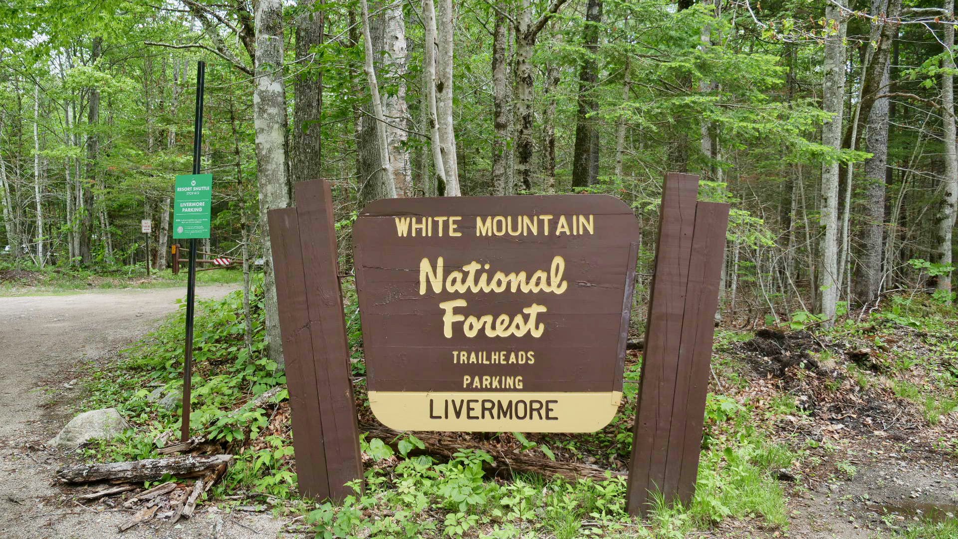
Livermore Trailhead
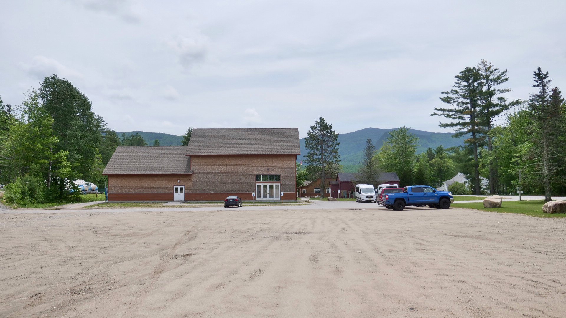
Snow’s Mountain Parking Lot
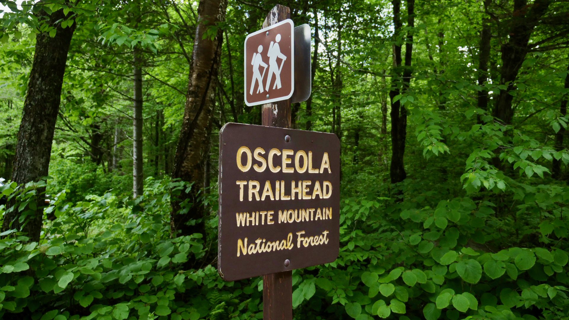
Osceola Trailhead
SUGGESTED ROUTES
2-DAY SKYLINE LOOP

Greeley Pond
DAY 1 - Park at Livermore Trailhead and begin on Greeley Pond Trail. Follow this scenic path until you reach Greeley Ponds Scenic Area, an alpine pond situated in the heart of the Mad River Notch. After passing the ponds, bear left towards Mt. Osceola Trail. After climbing and descending Mount Osceola, you'll find yourself at Tripoli Road. Follow Tripoli Road westward until you reach West Tecumseh Trailhead. From here, you will summit West Tecumseh and Mount Tecumseh. After descending, you’ll arrive at Tecumseh Trailhead (located by the ski area). You'll come out to a large parking lot. Turn left and follow the parking lot downhill until you come across signs for the Pipeline X-C ski trail. Follow the Pipeline Trail for half a mile until you reach Tripoli Road. Head eastward on Tripoli Rd. and turn left at the bridge. After you cross the bridge, head into Livermore Trailhead and follow signs for the Connector X-C Trail. Follow the Connector trail until you're back on West Branch Rd., and then turn right onto Bouler Path Rd. After passing the tennis courts, turn left onto Snow's Mountain Rd. Follow this road for 0.4 miles until you see signs for Snow's Mountain Trail. Embark on Snow's Mountain Trail. Towards the bottom of your descent, keep right onto Greeley Ledges Trail and then straight onto Elephant Rock Trail. When you reach the next trail junction, keep right towards Boulder Path, and follow that trail until you reach Livermore Road. Turn left on Livermore Road and follow this trail for 0.6 miles until you're back at Livermore Trailhead. Stop by Coyote Grill for some elevated American fare. Rest up for another full day of hiking!
DAY 2 - Begin at Livermore Trailhead. Follow Livermore Road for 1 mile and then keep left onto Kettles Path. After summiting The Scaur, keep right onto Irene's Path. Rest up and cool off at the Waterville Flume before heading up Old Skidder Trail. Turn right onto Livermore Trail and follow for another mile. Keep left at the fork on Scaur Ridge. When you reach Pine Bend Brook Trail, turn right and follow the trail to the summit of North Tripyramid. Keep left onto Mount Tripyramid Trail, where you'll summit Middle Tripyramid and South Tripyramid. Continue your descent down Mount Tripyramid Trail. Turn right at Livermore Trail and continue for 0.4 miles. Keep right following the signs for Upper Snows X-C Trail. After traversing down Upper Snow's Trail for about 0.5 miles, follow the signs for Cascades Path. You'll pass a series of cascading waterfalls and plunge pools, where you can cool off or simply take a well-deserved break. Continue along Cascades Path until you reach Boulder Path. Follow Boulder Path to Livermore Road, where you'll turn left and follow the trail for 0.6 miles until you reach Livermore Trailhead. Hop in the car and swing by Jugtown Country Store and buy yourself a tall, cold adult beverage - YOU'VE EARNED IT!
3-DAY SKYLINE LOOP

Cascades Waterfall
DAY 1 - Park at Livermore Trailhead and begin on Greeley Pond Trail. Follow this scenic path until you reach Greeley Ponds Scenic Area, an alpine pond situated in the heart of the Mad River Notch. After passing the ponds, bear left towards Mt. Osceola Trail. After climbing and descending Mount Osceola, you'll find yourself at Tripoli Road. Follow Tripoli Road westward until you reach West Tecumseh Trailhead. From here you will then summit West Tecumseh and Mount Tecumseh. After arriving at the Tecumseh Trailhead (located by the ski area) you'll come out to a large parking lot. Turn left and follow the parking lot downhill until you come across signs for the Pipeline X-C ski trail. Follow the Pipeline Trail for half a mile until you reach Tripoli Road. Head eastward on Tripoli Rd. and turn left at the bridge. After you cross the bridge, return to Livermore Trailhead. Treat yourself to some al fresco dining! Stop by Town Square for outdoor dining at Olde Waterville Pizza Co., La Hacienda, or Valley Pub.
DAY 2 - Begin from Snow's Mountain Parking Lot. Begin walking up the old ski trails on Snow's Mountain, following underneath the chairlift. After the first steep, keep to the right of the trail. You'll see a sign for Snow's Mountain Trail. Embark on Snow's Mountain Trail. As you descend, keep an eye out for Greeley Ledges Trail, which will be on your right. Follow Greeley Ledges Trail and then continue onto Elephant Rock Trail. Follow this trail for 0.4 miles and then turn right onto Cascades Path. Follow Cascades Path and cool off in the Cascades' revitalizing waterfalls and swimming holes. After taking a well-deserved break, head left onto Upper Snow's X-C Trail. Continue down this trail for 0.5 miles until you reach Livermore Road. Turn left onto Livermore Road and continue down this trail all the way back to the trailhead.
DAY 3 - Begin at Livermore Trailhead. Follow Livermore Road for 1 mile and then keep left onto Kettles Path. After summiting The Scaur, keep right onto Irene's Path. Rest up and cool off at the Waterville Flume before heading up Old Skidder Trail. Turn right onto Livermore Trail and follow for another mile. Keep left at the fork on Scaur Ridge. When you reach Pine Bend Brook Trail, turn right and follow the trail to the summit of North Tripyramid. Keep left onto Mount Tripyramid Trail, where you'll summit Middle Tripyramid and South Tripyramid. Continue your descent down Mount Tripyramid Trail. Turn right at Livermore Trail and continue down this trail until you're back at Livermore Trailhead. Stop by Jugtown and reward yourself with an adult beverage and some Boar's Head meat and cheese! Enjoy your snacks and libations on the picnic tables at Corcoran Pond (Waterville Valley is an open container town!).