Hiking Along Waterville’s Nordic Trails
Waterville Valley is home to one of the largest Nordic trail systems in the country. With over 71km of Nordic trails, professional nightly grooming, and awe-inspiring natural beauty, the Waterville Valley Resort Nordic Center has consistently been ranked one of the best in North America by USA Today (placed #4 in 2023).
These Nordic trails are not a one-season wonder. During the summer, hikers of all ability levels traverse our Nordic trails to explore the White Mountains. Nordic trails double as spectacular hiking trails for several reasons. Firstly, just like alpine skiing, each trail is designated with a green circle (beginner), blue square (intermediate), or black diamond (advanced). Even if you are unfamiliar with our Nordic trails, you can easily choose a hike based on your ability level. Looking for a leisurely hike with a gentle pitch? Stick to green circle trails. Up for more of a challenge? Head towards our longer blue square trails or even black diamond trails.
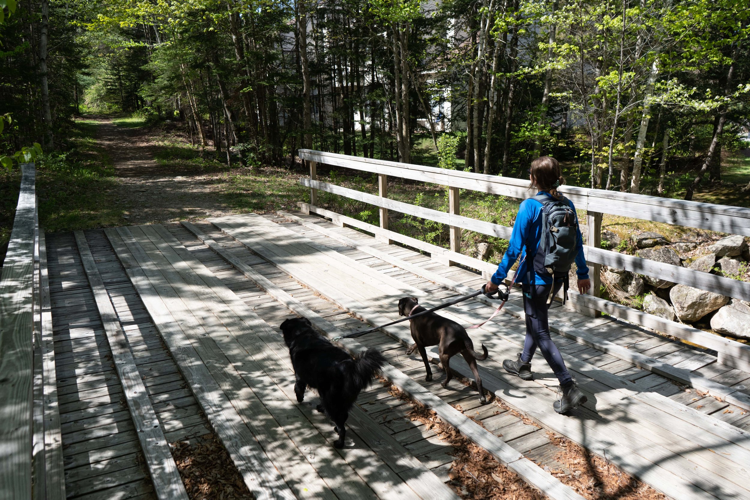
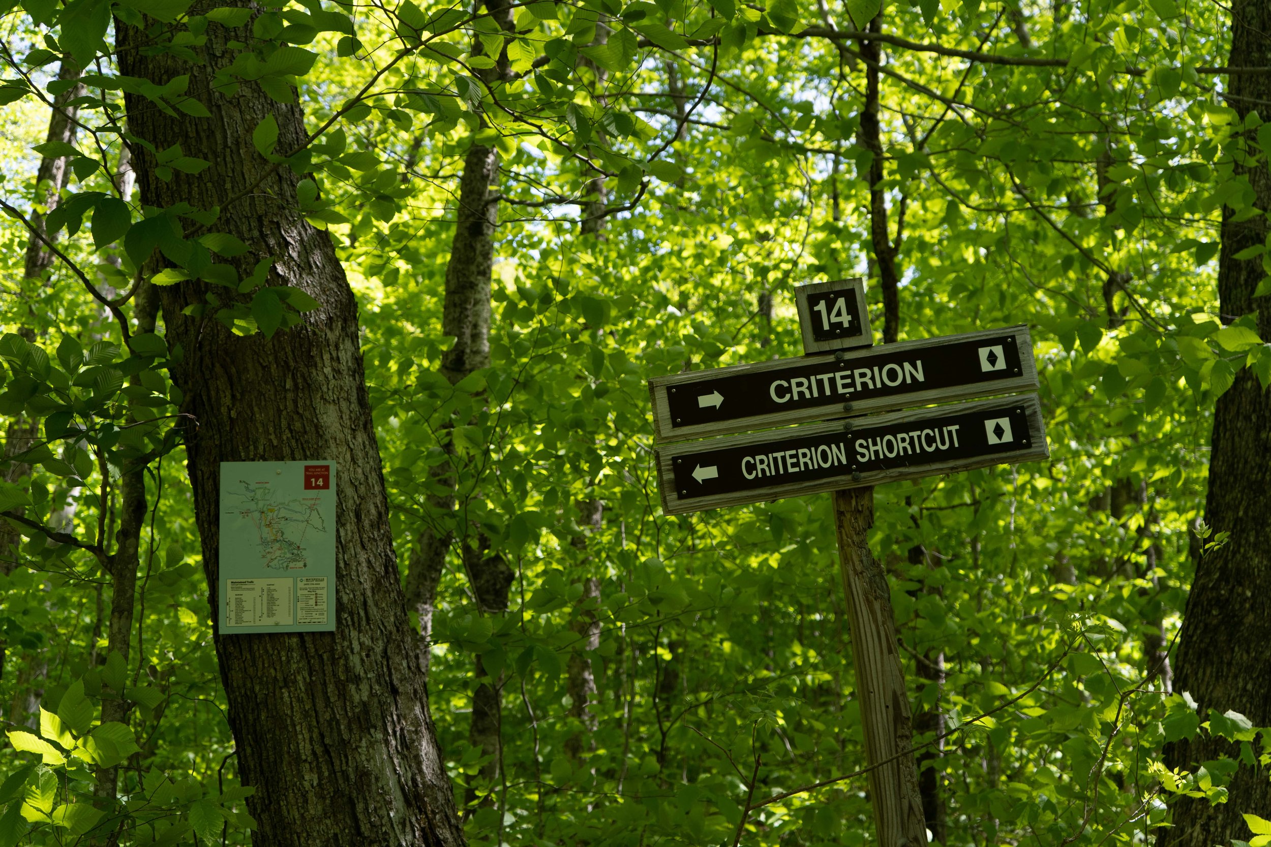
Nordic trails are much wider than the average hiking trail, spanning a width of 15 feet. This expansive trail width means you and your go-to hiking buddy can comfortably hike side-by-side, plus you can enjoy sweeping views of the trail ahead. Another perk to hiking along Nordic trails is the presence of trail junctions. Trail maps are posted at almost every trail junction, so you can easily navigate the trail system, or even explore new trails on a whim.
Due to snowmelt runoff, certain Nordic trails are wetter and muddier than others. We recommend steering clear of these trails after rainfall: HB Highway, Upper Fletcher's, Middle Fletcher's, and parts of Upper Criterion. Below is a hiking guide to our Nordic trails. If you’re in need some mid-hike snacks, stop by Jugtown Country Store and pick up some locally sourced jerky.

BEST TRAILS BY ABILITY LEVEL
BEGINNER: Pond Loop
INTERMEDIATE: Inner & Outer Mad River
ADVANCED: Upper Criterion

CLICK TO ENLARGE
BEST MULTI-TRAIL HIKES
Snow's Brook -> Roughrider -> Snow's Mountain
Begin your hike from Town Square. Head toward the first tee of the Town Square Disc Golf Course. In between the first tee and the red fencing, you'll see a trail that follows the banks of Corcoran Pond. Walk along this trail and through the tunnel, turning right at Trail Junction #18. You will approach a large house on your left, keep right at the fork, and right again at the next fork. Follow Pond Loop Trail until you reach Trail Junction #3, then follow the signs for Snow's Brook.

Once you reach Trail Junction #12, turn left and cross the bridge, following the signs for Criterion Access.

As you reach Upper Criterion at Trail Junction #13, follow the directional signage and turn right onto the trail.

At Trail Junction #14, keep left following the signs for Criterion Shortcut.
After you pass the shortcut, you'll notice a fork in the trail at Trail Junction #73. Keep to the left of the fork and continue uphill onto Roughrider. Follow Roughrider until you reach Trail Junction #74, and turn left on Upper Snow's Trail.

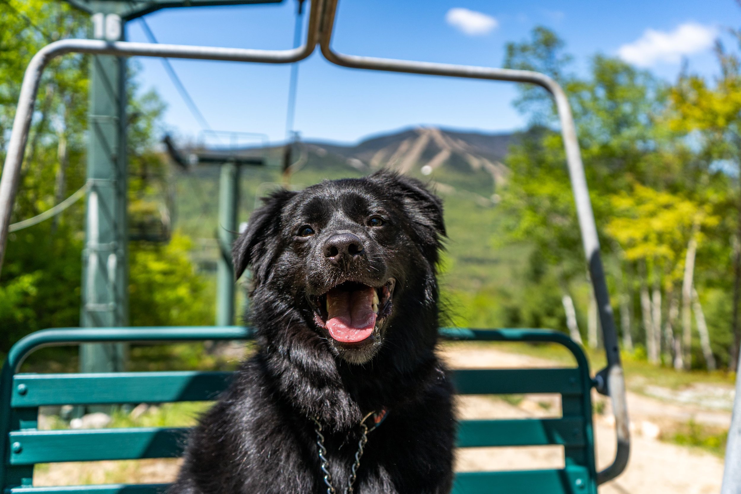
After about 5 minutes, you'll reach the top of Snow's Mountain Chairlift where you can take in stunning views of Mount Tecumseh and Mount Osceola. From there, we recommend hiking down the ski trails to the base of Snow's Mountain, where you can stroll back to Town Square on Boulder Path Rd.


Pond Loop -> Figure 3-> Sloppy Joes -> Lower Fletcher's
Begin in Town Square and walk past the beach, along the dirt road, and over to the right-hand back corner of the Osceola Arbor parking lot. Cross over a small wooden bridge and turn left into the tunnel. Walk past the White Mountain Athletic Center into the woods. Within 2-3 minutes you will reach Trail Junction #21. Continue walking straight, following Figure 3. Continue following Figure 3 until you reach Trail Junction #60, where you will turn right onto Sloppy Joes. Continue past Trail Junction #8 and #7, following signs for Lower Fletcher's. Eventually, you'll be back at Trail Junction #21, where you can follow the Pond Loop to return to Town Square, or you can continue exploring!
Drake's Brook -> Dry Jones -> Jenning's Peak
Begin from Drake's Brook Parking Lot on Route 49. Follow the signs for the blue square trail Drake's Brooke. You will continue hiking uphill, following the brook until you reach Trail Junction #6. Turn left onto Dry Jones and continue to Trail Junction #7. Turn left onto Lower Fletchers. You will quickly come across Trail Junction #4, where you will keep left on to Jennings Peak. Follow Jennings Peak back to the parking lot.
Swazeytown -> Bean Bender -> Snow's Mountain
Begin from Snow's Mountain Parking Lot. Follow the signs for Cascades Path as you ascend a grassy hillside along Cascade Ridge Road. Continue following this trail until you reach a fork, Trail Junction #26. Keep left following signs for Lower Snow's Mountain Trail. Continue along Lower Snow's Mountain Trail until you reach Trail Junction #35, where you will veer right towards Swazeytown. At Trail Junction #32, you will continue to Bean Bender. Eventually, you will reach the top of Snow's Mountain Chairlift. From here, you can continue exploring Nordic trails or simply hike down Snow's Mountain on the old alpine ski trails. Or bring a disc with you and play a round of disc golf on your trek back down the mountain.
Lower Snow's -> Cascades Brook -> Upper Snow's
Begin from Snow's Mountain Parking Lot. Follow the signs for Cascades Path as you ascend a grassy hillside along Cascade Ridge Road. Continue following this trail until you reach a fork, Trail Junction #26. Keep left following signs for Lower Snow's Mountain Trail. Continue straight past Trail Junction #35. When you reach Trail Junction #65, turn right. Shortly after, you'll reach Trail Junction #27, where you'll turn right again, following signs for Cascade Brook. Follow this advanced trail until you reach Trail Junction #38. From this junction, you have the option of exploring deeper into Cascades Falls: a series of breathtaking waterfalls, cascades, and plunge pools. If you decide to hike Cascades Path, simply follow Lower Snow's Mountain Trail back the way you came. If not, you can continue to Upper Snow's Mountain Trail, where you will eventually reach the top of Snow's Mountain Trail. From the top of the chairlift, you can either hike down the old alpine ski trails back to the parking lot, or you can take Bean Bender and Swaezytown back to Lower Snow's Mountain Trail.